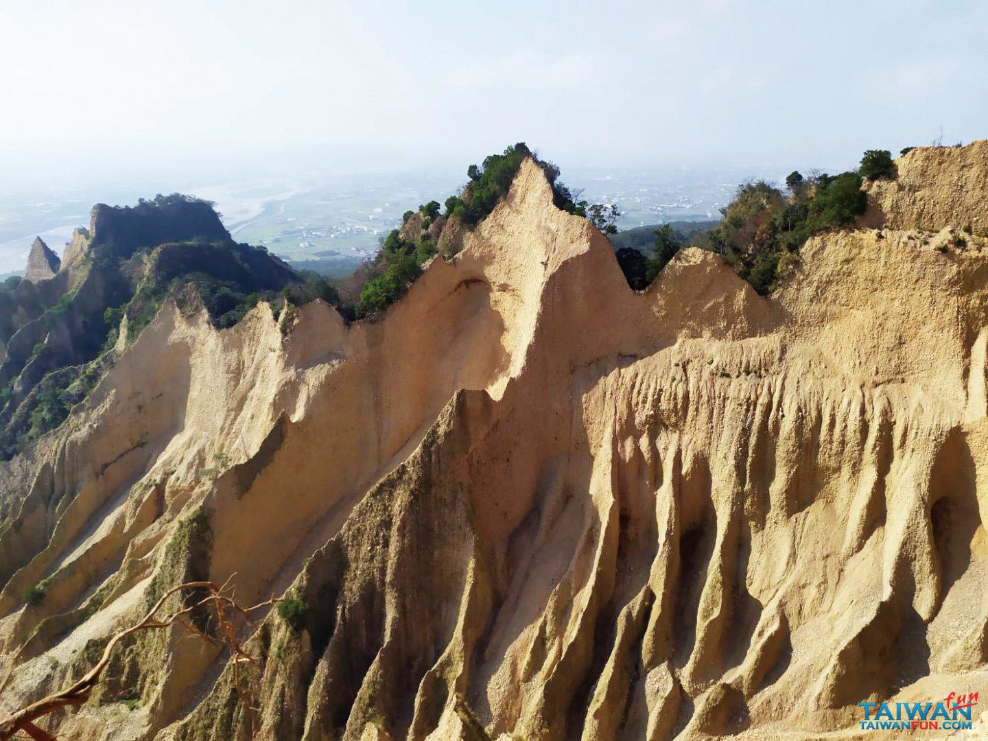
Huoyan Mountain (Huoyanshan), located on the border of Miaoli County’s Sanyi and Yuanli townships, is included among Taiwan’s top “hundred small peaks” and was voted No. 1 on an online hiking-trails survey. Its attributes include unique scenery, featuring sharp bare hills, a convenient location, accessible trails that only take about three hours to hike, and mountain-top views that make it an excellent Instagram photo-taking venue.
If you take National Freeway No. 1 north from Taichung, you’ll see Huoyan Mountain to your left on the north bank of Da’an River after about 15 minutes. After taking the Sanyi Interchange exit, follow the signs to Provincial Highway No. 13 (don’t go up to the bridge). This route travels downhill and meets County Highway No. 140, where you can make a U-turn and park your car beneath the overpass for free. Cross the road and you’ll see trailhead. You won’t need to worry about getting lost because Huoyan Mountain is a popular trail and it is clearly marked with signs.
Although the trail is surfaced with red soil and rocks and travels between trees, it’s still relatively easy to hike, even for senior citizens and children. As you continue, you’ll come to the South Huoyan Mountain geographic point which, a few steps away, offers a beautiful canyon-like scene. The main trail eventually loops around and ends up back at the start point. This venue is so popular because it doesn’t take much effort to appreciate full mountain vistas. Hikers usually take their time, snapping photos of the rewarding panoramic mountain views of the fields, roadways and Da’an River.
You can take a break and then continue up to Huoyan Mountain’s triangular terrace at the top. However, if you only want to take in the canyon scenes, you can turn around and head back to the parking lot. Those feeling a bit more energetic can also travel along the circular Nan An Old Trail, pass by a residential area, listen to some barking dogs, and bypass a bit of Province Highway No. 13, before getting back to the overpass and your car. If you want to take this highway north, you’ll actually need to drive south and make a U-turn on an industrial road first before getting back get back onto Highway No. 13 and connecting to the Sanyi Interchange.
Finally, if you’re feeling a bit hungry at this point, heading north on Province Highway No. 13 and passing a gas station and traffic light will bring you to two local restaurants selling Hakka-style flat noodles and an abundance of broiled delicacies for reasonable prices.
位於苗栗三義鄉與苑裡交界處的火炎山,是台灣小百岳之一,也是網路票選第一名必走的健行登山步道。除了如火焰般通紅的特殊地質山貌,便利的交通,親民的步道,只需約3小時即可遍覽全貌,也是IG拍照美點。 由台中出發上國道1,約15分鐘到達三義前看到左手邊(大安溪北邊)醒目的火炎山,由三義交流道下,照著指標往南接上台13線順著右側道路(別上高架)大斜坡一路下到與140縣道的交叉口,可將車子大迴轉停於橋下的免費停車場。由於火炎山已是熱門登山健行步道,沿路指標很清楚,跨過馬路即可看到登山口,然後就輕鬆健走了。 全程紅土石子步道穿梭於林蔭間,坡度平緩無攀爬困難度,老人小孩皆可慢步徐行。首先到達的是南火炎山地標,再來緩緩而上,即可一路隱約瞥見大峽谷地貌,就算偶有叉路最後都會匯回主幹道,挑容易的走。火炎山會讓人著迷的因素之一是不用花太多力氣即可看到山景,一路由小小的一角就開始吸引登山者,慢慢走、慢慢拍照,一直走到頂端豁然開朗,整個峽谷的面貌盡收眼底,呈最大角度開放,視野遠眺大安溪上交錯的公路、田野…,這是爬山健行的最大回饋! 稍做休息再繼續往上走才是火炎山三角點,若只純賞大峽谷地貌,不以攻頂為目的,建議可原路往返到停車場。腳力體力充沛者,可續走攻頂後沿著南鞍古道指標走一個O型、經過民宅、狗吠、一小段台13公路,一樣會回到橋下停車場。車子從停車場如果要回到往北的台13線,因為道路設計詭異,請先往南出口再北折走左側的產業道路一小段,才能接回台13線、上三義交流道。 停車場往北台13線,過加油站、紅綠燈,右側有兩家在地小吃店,賣的客家板條、滷味小菜,料多可口價格親民。